Mapping is a process based on finding the correspondence between elements in real life and transporting them on a map, that can be physical or online.
My journey regarding the activity of mapping started by downloading the app MapSwipe on my mobile device.
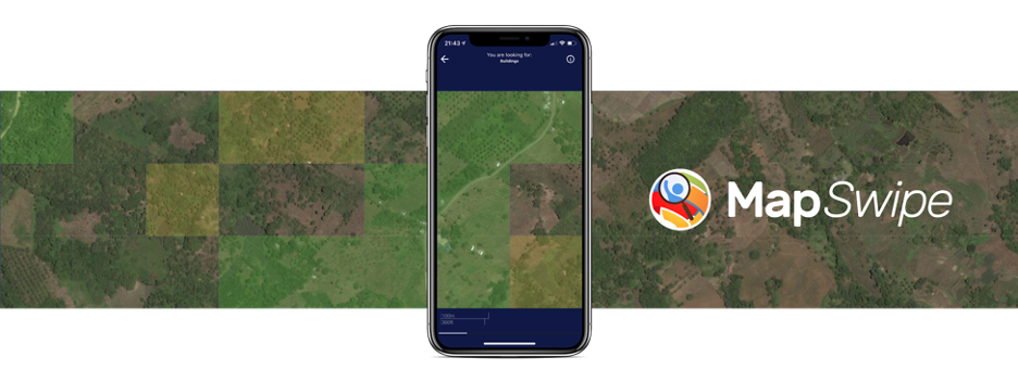
MapSwipe, developed in collaboration with the Missing Map Project, has the purpose of helping humanitarian organizations that are working in remote areas that haven’t been mapped, and for this reason, are difficult to find. By swiping through satellite images, the user will help organisations coordinate humanitarian efforts to save lives, from everywhere around the globe, by the comfort of just using their phone.
The process that I personally undertook was to first download the app on my phone and sign in with my email to create an account. Once my profile was set up, the interface showed all of the currently active projects around the world: Peru, Papua New Guinea, Bangladesh, Nepal, India, Brazil, and more. I picked my first task – Finding buildings in Huánco province in Peru – and once I clicked on it, a useful tutorial popped up, providing the fundamental information about how the mapping on this worked. Once I started, a satellite image showed up on my screen, divided into six squares.
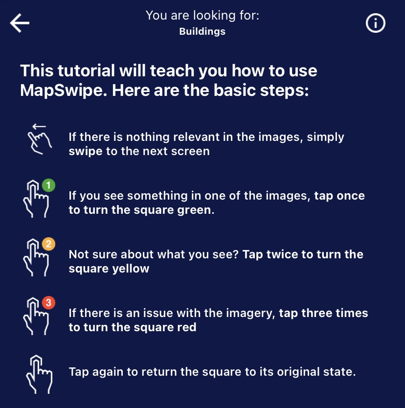
My task was to track the buildings and if one occurred in one of the squares I had to click on it once, to turn the square green. If I wasn’t sure about what I was seeing in a square, I could click on it twice, turning the square yellow. Lastly, if there was an issue happening in one of the squares, such as a cloud covering the area, or a low resolution frame, tapping three times on it to turn it red.
All of the images are viewed multiple times from different users, in order to avoid errors and be as specific as possible in the final result. By participating in projects and mapping, each user will gain experience and reach new levels on the app, which will be shown in the profile, providing the total swipes, the total time spent swiping through images, the total area swiped in square kilometres, the number of projects, the number of organizations supported, and a contribution heatmap of the last 30 days of usage.
I’ve personally found this first mapping tool very intuitive and interesting, especially for its purpose, which can transform something as easy as following instructions and mapping places, into something that can give a solid contribution to help people around the world.
The second tool that I used in my mapping journey is OpenStreetMap, a free and openly accessible geographic database managed by a community of volunteers worldwide, that will update it thanks to their knowledge, geodata sources or data from surveys.
OpenStreetMap originated in 2004 when Steve Coast launched the project to create a free and editable map of the world, as a response to the limitations of the Ordnance Survey from the United Kingdom’s national mapping agency, which failed to release its data to the public under a free license. Over time a community of volunteers grew around the project, improving the map’s coverage and accuracy.
As for the other tool, once I’ve searched for OpenStreetMap in my browser, the first thing to do is to sign in with an email and create an account. Once logged in, the user will gain access to the map interface, which will enable them to move around freely and explore different areas. The platform will encourage the users to see what has and what hasn’t been mapped yet, and actively participate in the activity of mapping. Another option, other than the free mapping, is to complete tasks, by recognising features from satellite imagery. OpenStreetMap Ireland, for example, is currently spawning a series of local tasks, than can be completed by users to improve the quality of the maps around the country.
To describe my personal experience with this tool, while looking around Ireland I realized that most of the Cork area that I knew was already mapped, and I so decided to move to Italy, to my hometown and have a look around it.
Brescia, the biggest city, was already heavily mapped, so I moved to the small village in which I used to live, Botticino Sera. While looking around the map, I found out that all of the streets were mapped with their names, but a few information were missing. I’ve started my process of mapping from the area close to my primary school, Scuola secondaria di primo grado Giovita Scalvini, by properly giving the name to the building.
Secondly, I moved to the area around the school. I’ve noticed that a few areas were mapped as residential areas, but others were not, so I made my contribution by mapping the ones that were missing. After that process was done, I started mapping houses, blocks of flats, buildings in general and private swimming pools. Also, many buildings were mapped but their shape didn’t reflect reality, so I resized and reshaped them correctly.
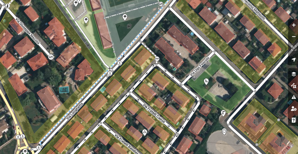
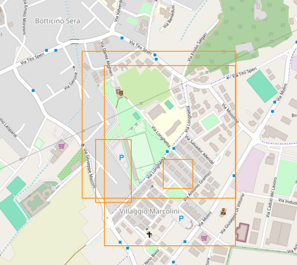
During my second and third sessions on OpenStreetMap, I focused again on the same elements, but I’ve also added parking spots, a local supermarket – that I have attributed information to – and I used the point option to mark all of the crosswalks on the main road close to the school. Lastly, I mapped a green area, trees and a wine shop and distillery that is in the same geographic area.
OpenStreetMap appeared to be very easy to use and editing the map was quite simple. All of the features for areas and points are extremely intuitive and the Help Button and Beginner’s Guide are very useful. It is untimely engaging, by allowing the user to map everything that is in a specific area, not just buildings and roads, but parks, trees, rivers, and much more.
The community around OpenStreetMap is also very passionate and supportive. Once I was done with my first session of mapping, the website suggested Telegram Channels with users who were working on the same area of my interest.
After this first experience with mapping tools, I can confidently say that I’ve become aware of a reality that I didn’t know was around me. The community around mapping it’s quite extended and it can lead to numerous benefits. First of all, it helps us to understand the world around us and see it from a different point of view. Having for example used MapSwipe, the tool that helps provide maps of remote areas around the world, made me realize that it is extremely important to keep maps always updated for navigation.
Going deeper, I would also say that maps represent a useful tool for everyone who is currently studying modern and past society. We can use them to make urban decisions, making our cities more man-sized or more green, and providing solutions that will help everyone to fit in.
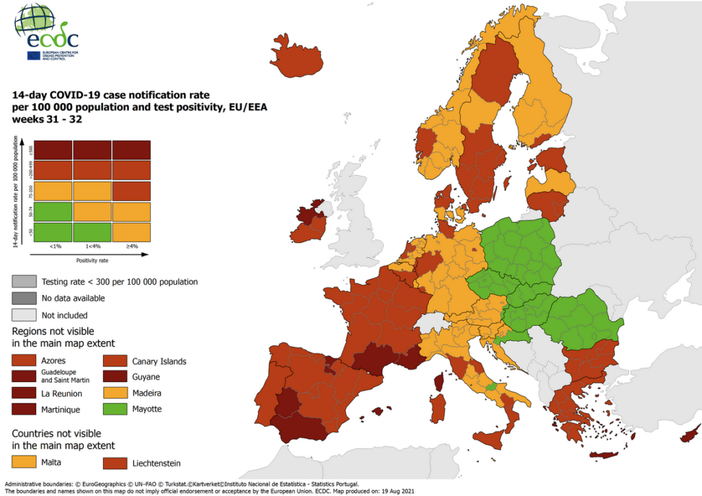
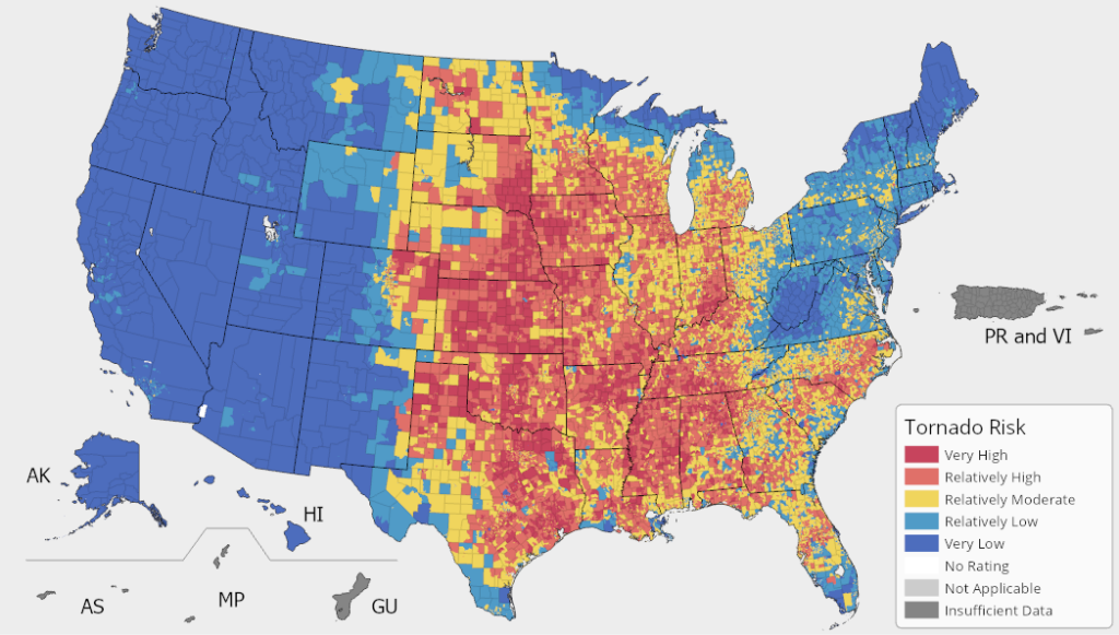
We used them in 2020, to follow the spreading of the epidemiology of COVID-19, and we can also use them for meteorology, to study natural phenomena, and to predict if a disaster is going to happen in a specific risk area, planning and coordinating in advance possible escape plans.
Additionally, they can be used not only for documenting cultural sights and places of cultural and touristic interest, but to also make a visual representation of history. All of the events, the battles and the wars that occurred during history took place in areas that we can study and track on maps to be able to visualize them.
For this reason, I think that being able to map areas and handle different tools, would represent an important skill to have both for academic and professional pursuits, especially in the field of digital humanities. Since everything can be studied and visualized with maps, and with tools like MapSwipe and OpenStreetMap, everyone in their small, can give a help to the wider community by mapping.